Walk 17.1 km along the vast Westeinder Lakes and historic forts, from Hoofddorp to Uithoorn. Discover the fortifications of the Water Line!
Waterline Trail Stage 06: Hoofddorp - Uithoorn (Amstel Bridge)
Discover the fascinating history and beautiful nature of the Amsterdam Defence Line and the New Dutch Water Line during this 17.1-kilometer stage of the Water Line Trail.
Directions
This stage takes you from Hoofddorp through a landscape shaped by battle and defense, but now an oasis of tranquility. You walk along the vast Westeinderplassen, formed by centuries of peat extraction. Here, you feel the wind rustling through the reeds and hear the lapping of the water. The route follows a succession of green grassy dikes that run through the landscape like veins, and you pass earthen ramparts here and there. These dikes connect historic forts such as Fort bij Kudelstaart with Fort bij de Kwakel, silent witnesses to a rich history. Along the way, you might see meadow birds nesting in the spring or enjoy the flowering aquatic plants in the summer. The tour ends at Fort aan de Drecht, strategically located on the picturesque River Amstel, where you can look out over the water and the surrounding area.
Highlights along the way
- Westeinderplassen: Admire the vast expanse of water, created by peat extraction, a paradise for water recreation and birds.
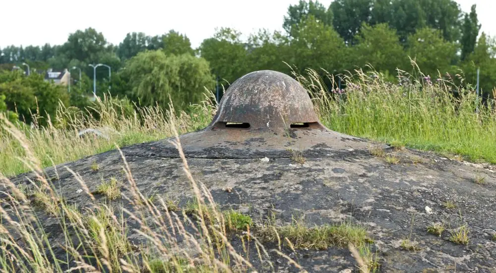
- Fort Kudelstaart: One of the forts of the Amsterdam Defence Line, built to defend the Netherlands.
- Fort bij de Kwakel: Another impressive fort that is part of the New Dutch Water Line.
- Fort aan de Drecht: The end point of this stage, beautifully situated on the Amstel, with a rich history.
Background story
This stage of the Waterline Trail immerses you in the ingenious defenses of the Amsterdam Defence Line and the New Dutch Waterline, both UNESCO World Heritage Sites. These lines are a unique example of military heritage, where landscape and water were utilized to protect the country. Through strategic inundation—flooding large areas—enemy troops were held back. The forts, dikes, and sluices you encounter along the way tell the story of a time when the Netherlands found a clever and effective way to defend itself.
Tips and practical information
- Dogs: Dogs are allowed on a leash on most of the route; please note any local exceptions near nature reserves.
- Public transport accessibility: The starting point in Hoofddorp and the end point in Uithoorn (Amstelbrug) are easily accessible by public transport. Consult 9292.nl for the most up-to-date travel information.
- Marking: The route is marked as part of the Waterliniepad (LAW 17); follow the red and white markings.
- Accessibility: Partly paved and unpaved paths. Parts of the route may be less suitable for wheelchairs and strollers.
- Seasonal restrictions: During the breeding season (generally from March 15 to July 15), some paths may be temporarily closed or specific rules may apply to ensure the peace and quiet of nesting birds. Please look for signs on site.
Kenmerken
- Accessible by public transport