-
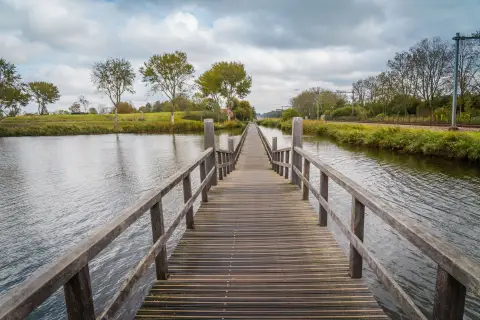
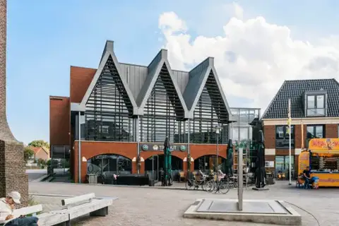
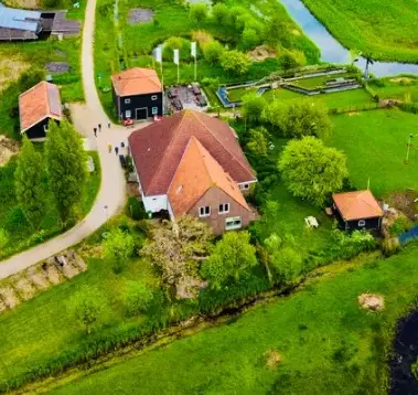
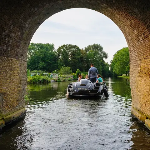
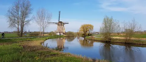
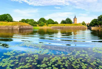
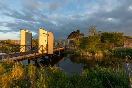
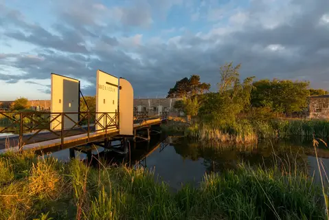
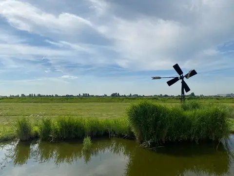
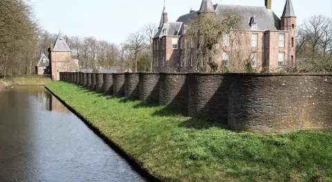
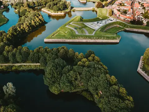
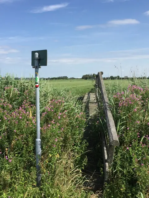
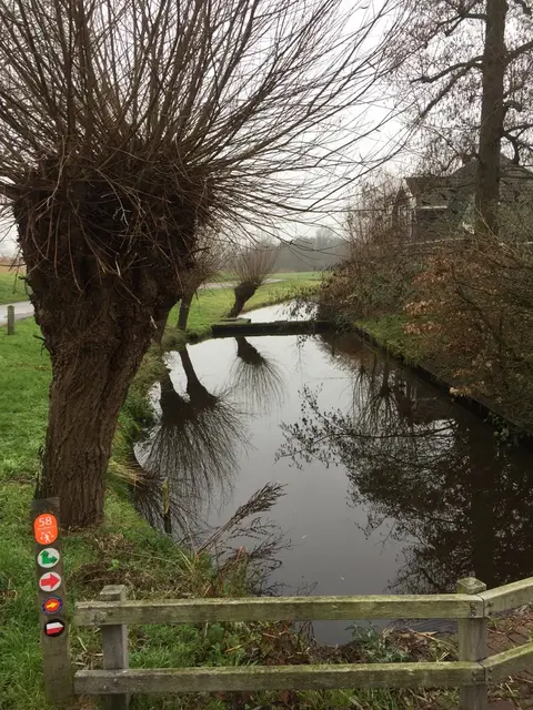
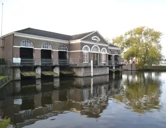
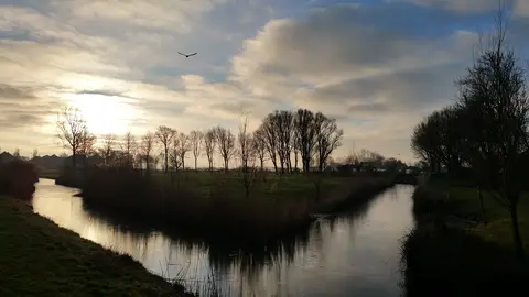
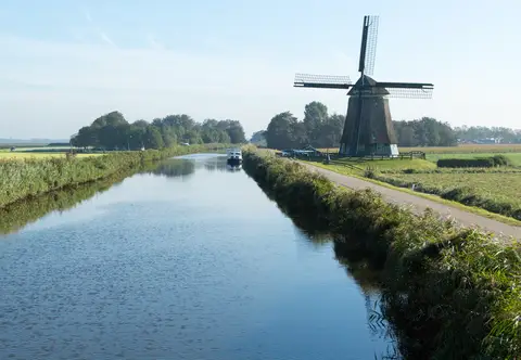
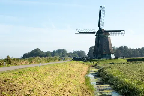
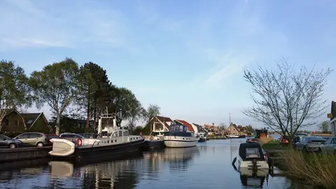
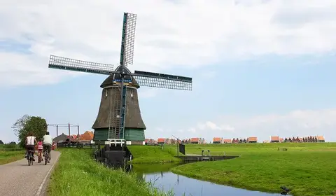
Spaarndamse sluizen-, gemalen- en fortenroute
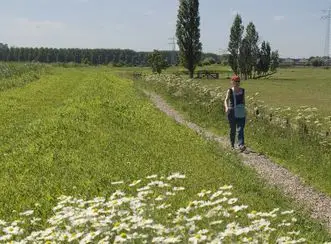
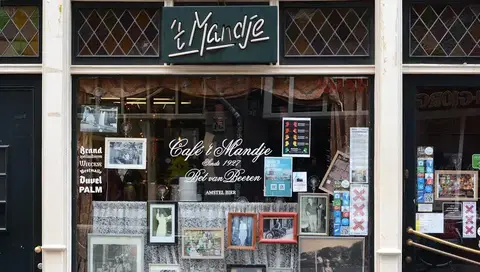
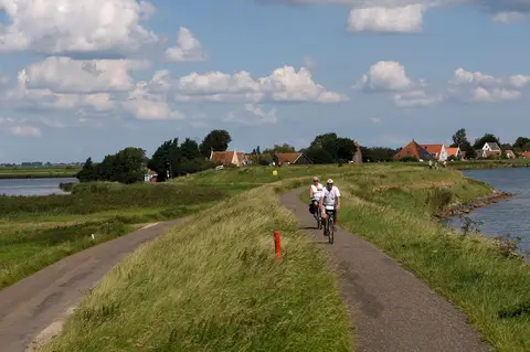
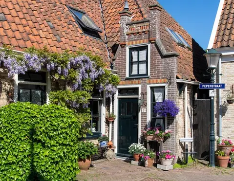
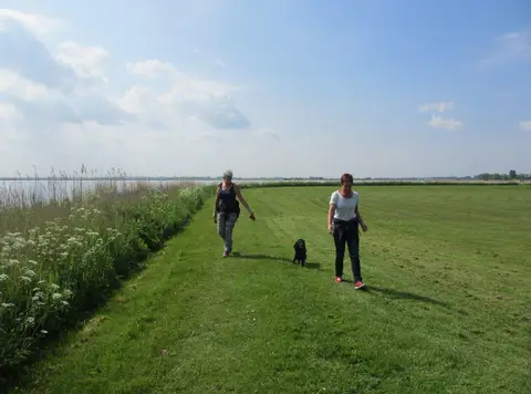
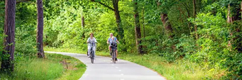
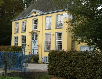
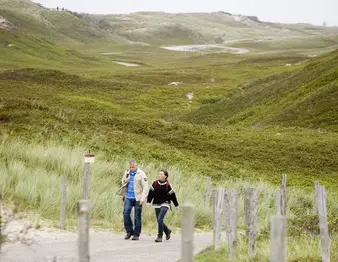
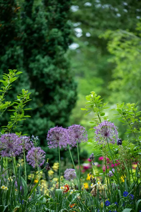
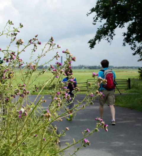
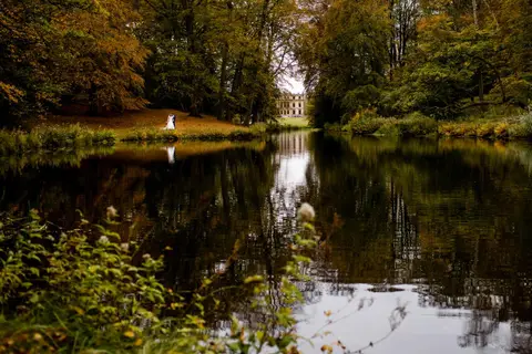
This cycling route starts in Spaarndam, which is known for its rich history and cozy atmosphere. Spaarndam is situated on the Spaarne and originated as a dam in the river. The village still has a charming appearance with old houses and narrow streets.
- Start location
- Spaarndam
- Distance
- 46.4 km
-
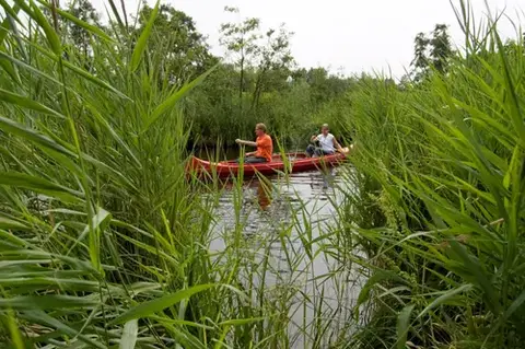
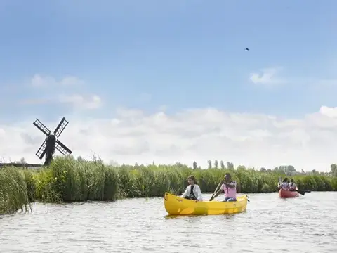
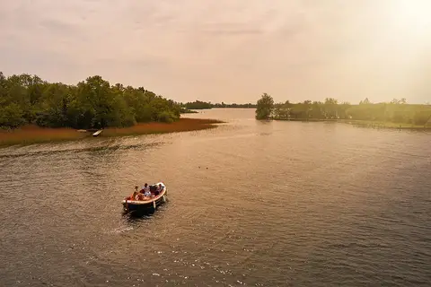
Amstelmeerkanaal: vaarroute Den Oever – De Haukes
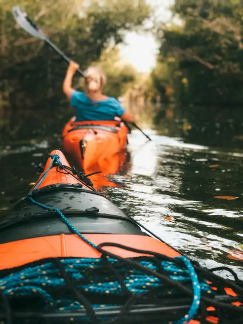
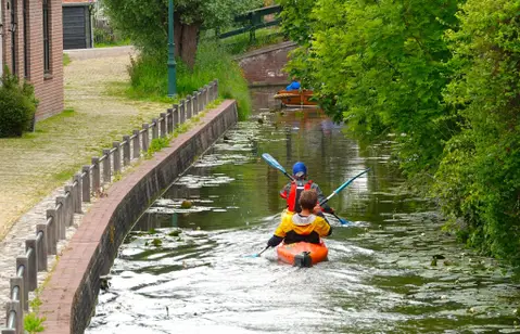
Paddle 9 km along the Amstelmeer Canal from Den Oever to De Haukes, a peaceful canoe, kayak, and SUP route through the former island of Wieringen.
- Start location
- Westerland
- Distance
- 9.0 km
-
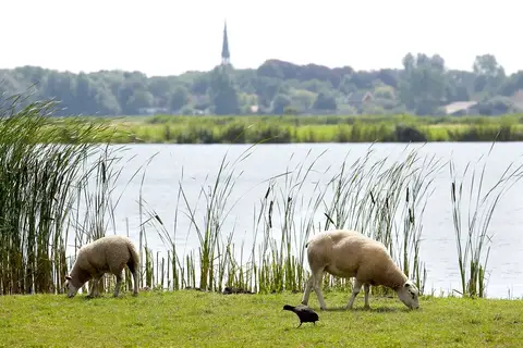
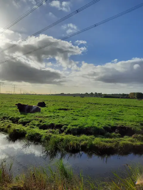
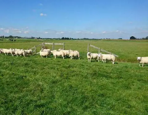
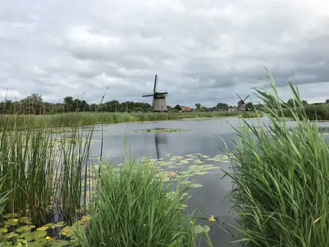
Langs dijken en velden
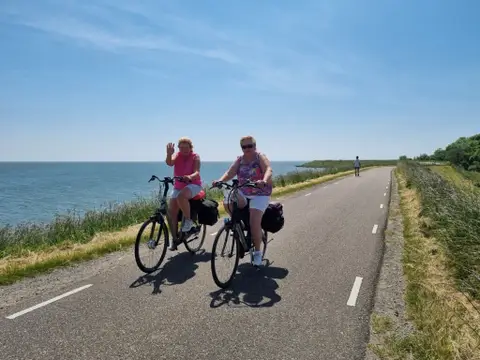
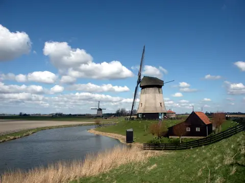
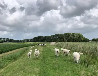
Discover the diverse landscape around Enkhuizen by bike. It is wonderfully quiet and spacious, with characteristic villages, meadows with cows and sheep, windmills, and views over the IJsselmeer stretching as far as the horizon.
- Start location
- Enkhuizen
- Distance
- 31.0 km
-
Ruiterroute Dijkgatbos
In the mood for a relaxing ride through nature? This 3.7-kilometer loop bridle path near Dijkgatbos offers you the chance to enjoy the beautiful surroundings of the northern tip of North Holland.
- Start location
- Wieringerwerf
- Distance
- 3.7 km
-

Amstelmeerroute
Discover Hollands Kroon by SUP, canoe, or kayak? You can listen to these interesting podcasts during your trip.
- Start location
- Westerland
-
De twee sluizenroute
Discover Hollands Kroon by SUP, canoe, or kayak? You can listen to these interesting podcasts during your trip.
- Start location
- Anna Paulowna
- Distance
- 11.0 km
-
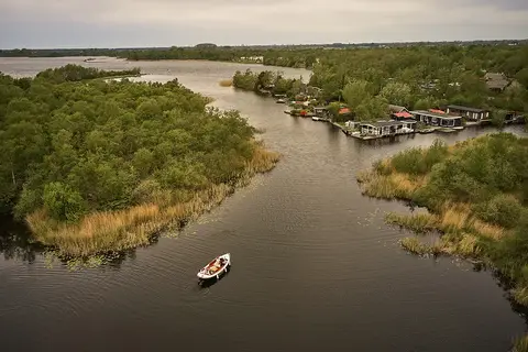
Vaarroute rondje Kolhorn
Fancy heading out on the water in a canoe, SUP, or kayak? Then come to Kolhorn! Three jetties have been built along the recently constructed waterway where you can moor for a short break.
- Start location
- Kolhorn
- Distance
- 3.4 km
-

Wandelen met uitzicht op de Waddenzee
Discover the beautiful area of the former island of Wieringen, an Eldorado for nature lovers and peace seekers. You walk along the Wadden Sea for a large part of the route.
- Start location
- Hippolytushoef
- Distance
- 15.3 km
-
Fietsen door de polders van Hollands Kroon
This route takes you through Hollands Kroon, a beautiful region in North Holland home to villages such as Den Oever and Wieringerwaard. You will enjoy beautiful vistas and the former island of Wieringen.
- Start location
- Den Oever
- Distance
- 55.4 km
-
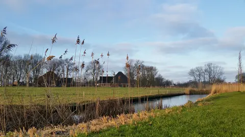
Hollands Kroon en Wieringen
Cycling through a landscape with open polders, abundant water, dikes, reed beds, arable fields, meadows, polder forests, and a former island.
- Start location
- Den Oever
- Distance
- 48.5 km
-
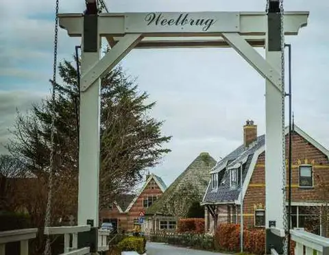
Leijenroute (zwart)
The Leijen Route (black), starting from the 't Verlaat starting point near Nieuwe Niedorp, initially runs alongside the Rondje Waarland and turns right at the Weelbrug towards 't Veld. It then continues along the grass strip beside the tree-lined Leijerpolderweg and the grass dike on the northern bank of the canal.
- Start location
- Oude Niedorp
- Distance
- 8.6 km
-
Het verhaal van Hollands Kroon Oost
Discover the eastern side of Hollands Kroon on an unforgettable cycling route. History is reflected everywhere in the landscape. Cycle through the vast Wieringermeerpolder, past sturdy pumping stations, picturesque villages, and historic dikes.
- Start location
- Den Oever
- Distance
- 57.7 km
-
Het verhaal van Hollands Kroon West
Cycle back in time on this beautiful cycling route: The Story of Hollands Kroon West. From colorful Anna Paulowna to charming villages such as Kolhorn, 't Veld, Winkel, and Nieuwe Niedorp. This route takes you along the old dikes, past former port towns and agricultural heritage.
- Start location
- Anna Paulowna
- Distance
- 66.6 km
-
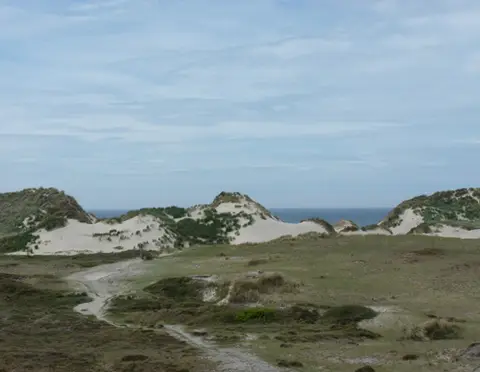
De onbekende schoonheid van Wieringen
This route takes you across Wieringen, the former island where the Afsluitdijk meets the shore in North Holland. Here, you walk through a rolling green landscape of moraines formed during the penultimate Ice Age, about 150,000 years ago.
- Start location
- Hippolytushoef
- Distance
- 15.1 km
-
MUZ-fietsroute | Wieringen & de Zuiderzeewerken
The MUZ cycle route largely runs along the edges of the former island. After all, it was there that the battle against the water had to be fought and the connection with the hinterland established. The traces left behind by the construction of the Zuiderzee Works can be found primarily here; the monuments that form part of Wieringen's turbulent history.
- Start location
- Den Oever
- Distance
- 37.6 km
-
Hoornse Hoproute
Discover De Hulk, the Dwaalpark, and the Markermeerdijk near Hoorn and the rustic village of Scharwoude — 4.7 km of enjoyment of water, nature, and VOC history.
- Start location
- Scharwoude
- Distance
- 4.7 km
-
De Blauwe Pontjesroute
Walk the Blue Ferry Route (3.9 km) through the Robbenoord Forest near Wieringerwerf. Cross the Hoge Kwelvaart for free on a cable ferry and enjoy beautiful forest paths!
- Start location
- Wieringerwerf
- Distance
- 3.9 km
-
Fietsroute langs natuur en historie
We have put together a beautiful bike tour through the entire Amstelland Green Area. Hop on your bike and enjoy!
- Start location
- Diemen
- Distance
- 40.0 km
-
Wandelroute Amstelveen
This walking route takes you past the gems of Amstelveen and the surrounding area, allowing you to enjoy the special things this region has to offer.
- Start location
- Amstelveen
- Distance
- 9.4 km
-
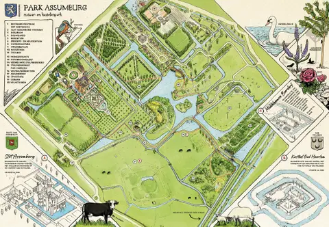
Wandeling Park Assumburg
Discover castles, a castle garden, and beautiful nature on this 3.7 km green walk through Assumburg Park in Heemskerk. Ideal for young and old!
- Start location
- Heemskerk
- Distance
- 3.7 km
-
Wandelroute Diemerbos en omringende polders
Go exploring in Diemen and let this walking route take you through the Diemerbos and the surrounding polder area.
- Start location
- Diemen
- Distance
- 9.9 km
-
(Kids) Rondje Elsenhove - speeltuin Elsenhove
At 1.78 km, the Elsenhove loop is manageable for the very little ones. If you want more, take an extra lap through the small park next to the parking lot (1.5 km).
- Start location
- Amstelveen
- Distance
- 1.8 km
-
(Kids) Rondje Gaasperplas met klimfeest
You can start this loop in two ways: via the south side (4.79 km) or the north side (5.35 km) of the Gaasperplas. The route is suitable for older children.
- Start location
- Amsterdam
- Distance
- 5.0 km
-
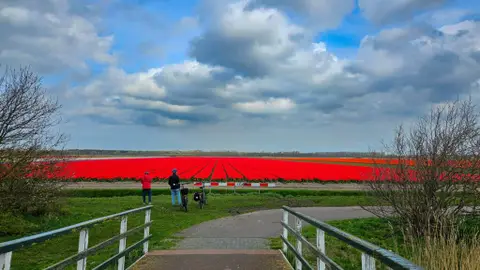
Bloembollenfietsroute
Did you know that the largest continuous flower bulb area in the world can be found in the northernmost part of North Holland? Here you can enjoy endless colorful fields stretching to the horizon. Perfect for a relaxing day out or a short vacation close to home.
- Start location
- Callantsoog
- Distance
- 47.3 km
-
NS-wandeling Helderse duinen
Yes, walking in and around Den Helder is absolutely worthwhile! This varied route starts at Den Helder Zuid station; easy to reach as the intercity train stops there. From the station, you head into the De Nollen nature reserve;
- Start location
- Den Helder
- Distance
- 9.5 km
-
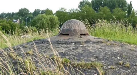
Napoleonroute
During this walking route of approximately 11 km, you will discover how Napoleon applied his military strategy. You will walk past various structures from the Napoleonic era, Dutch defensive works, and impressive German bunkers from the Second World War.
- Start location
- Den Helder
- Distance
- 11.0 km
-
Recreatief en historisch Oostzaan
Put on your walking shoes and discover Oostzaan in a surprising way!
- Start location
- Oostzaan
- Distance
- 10.0 km
-
Het Smaal
Mountain bike route 'Het Smaal' is a beautiful route through the Het Twiske recreational area. The route is suitable for children and beginners, but advanced riders can also have a great time here.
- Start location
- Oostzaan
- Distance
- 3.5 km
-
De Vennenroute
Enjoy a lovely paddle in Het Twiske along the yellow route. Discover the beautiful watery spots in this magnificent recreational area.
- Start location
- OOSTZAAN
- Distance
- 7.5 km
-
Rondom Watergangroute
The Rondom Watergang Route is a varied cycling tour around the old "boating village" of Watergang, through the Ilperveld, Het Twiske, and along the Gouwzee.
- Start location
- Oostzaan
- Distance
- 35.0 km
-

Rondje Schaalsmeerpolder
Birdwatching in the polder between Oostknollendam and Wormer.
- Start location
- Wormer
- Distance
- 4.4 km
-
Wandelroute Wormer
The most varied walk of all ten, featuring both sweeping views and heritage. With the Zaan as the grand finale. The Wormer- and Jisperveld is the largest continuous peat meadow area in Western Europe.
- Start location
- Wormer
- Distance
- 7.5 km
-
Laarzenpad Wormer
This is no ordinary walk. The Wormer Boot Path takes you into the heart of the Jispervelden, one of the most authentic and relatively unknown meadow bird areas in North Holland.
- Start location
- Wormer
- Distance
- 7.6 km
-
Twiske Vaarroute
The Oostzanerveld is a gem in an urban setting. Here, people and animals enjoy the hundreds of small islands and numerous ditches in complete tranquility… And all this just outside Amsterdam! Did you know that the Oostzanerveld is even a Natura 2000 site?
- Start location
- Oostzaan
- Distance
- 16.0 km
-
Uitgeestermeerroute
If you enjoy open water, wind, and some waves – and also have some canoeing experience – the Uitgeestermeer route is highly recommended. Posts/buoys with a blue band mark the canoe route. Enjoy the exertion and relaxation of a day of paddling under your own power.
- Start location
- Uitgeest
- Distance
- 5.5 km
-
Woudpolderroute
This route is for canoeists seeking the tranquility of the polder, the shelter of reed beds, meadows with cows and sheep, and nesting birds. The canoe route is marked in green. Enjoy the exertion and relaxation of a day of paddling under your own power.
- Start location
- Uitgeest
- Distance
- 8.5 km
-
De Crommenijeroute (9,5 km)
A trip for lovers of cultural history, old lakes, reed beds, and low farm bridges. Due to the thick reed beds, there is little wind and few waves.
- Start location
- Uitgeest
- Distance
- 9.5 km
-
De Stieroproute
The Stierop Route takes you through peaceful polders, a vast nature reserve, and among other water sports enthusiasts and boats on the Markervaart and the Uitgeestermeer.
- Start location
- Uitgeest
- Distance
- 10.5 km
-
Busch en Dam & Krommenieroute
This purple-marked route is a line from Busch en Dam to Krommenie. A beautiful connection with nice stops at special spots along the way.
- Start location
- Krommenie
- Distance
- 5.0 km
-
Dorregeesterpolderroute
To the northeast of Uitgeest you will find the Dorregeesterpolder, a lesser-known but beautiful part of the Alkmaarder- en Uitgeestermeer recreational area. Put on your walking shoes and enjoy the nature, the wind in your hair, and the surprising views across the water.
- Start location
- Uitgeest
- Distance
- 6.0 km
-
Klaas Hoorn- en Kijfpolderroute
On this walk through the Klaas Hoorn- and Kijfpolder nature reserve, you stroll through meadows among cows and along the shores of the lake. A beautiful, not too long walk to clear your head and enjoy nature.
- Start location
- Akersloot
- Distance
- 3.0 km
-
Fietsroute Van Oer-IJ-gebied naar recreatiegebied
This route takes you back in time, through picturesque landscapes along water, past forts and meadows, over winding dikes and old bridges. In the past, the Oer-IJ flowed here, a branch of the Rhine that emptied into the sea at Castricum. When it was closed off, a large peat bog formed. To make the land suitable for arable farming and livestock breeding, ditches were dug and dikes were built.
- Start location
- Uitgeest
- Distance
- 50.0 km
-
Pontjesroute Noord-Holland
This 47-kilometer bike tour takes you via various ferries around the Alkmaarder and Uitgeester lakes through the water-rich heart of the province.
- Start location
- Castricum
- Distance
- 47.0 km
-
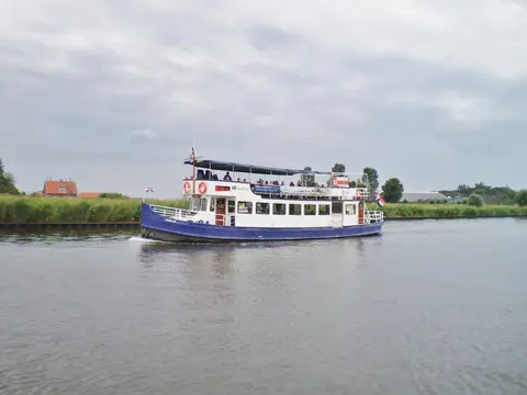
Historische vaarroute Enkhuizen
For centuries, West Frisian farmers and market gardeners have sailed their boats through the ditches every day to their scattered fields.
- Start location
- Bovenkarspel
-
Rondje IJsselmeer met fiets en veerdienst
Discover three provinces with this unique multi-day cycling route totaling 153.6 km around the IJsselmeer. Along the way, you cross the water three times using various ferry services! In short, a route bursting with culture, nature, architecture, and history. This route was created by the Marrekrite Recreation Authority, the Municipality of Urk, and the Westfriesland Recreation Authority.
- Start location
- Opheusden
- Distance
- 153.6 km
-
Aandammerroute – Vaarroute door Waterland-Oost
Start in Monnickendam and paddle or sail 15 km through the tranquil Waterland, past historic villages, reed beds, and rare orchids. Discover Broek in Waterland, Holysloot, and Uitdam from the water!
- Start location
- Monnickendam
- Distance
- 15.0 km
-
Streekpad Westfriese Omringdijk
Walk 150 km along the historic West Frisian Ring Dyke (SP9) past Hoorn, Alkmaar, Medemblik, and Enkhuizen. Divided into 8 daily stages, marked yellow and red.
- Start location
- Hoorn
-

Wandelroute door de romantische stad
Discover Amsterdam through romantic, wondrous, and sometimes moving stories associated with iconic buildings and locations.
- Start location
- Amsterdam
-
Wandelroute voor een betere planeet
Set out to visit Amsterdam pioneers in the fields of sustainability, urban agriculture, and greening.
- Start location
- Amsterdam
- Distance
- 9.5 km
-
Wandelroute in de voetsporen van vrouwen
Set out to visit places that commemorate famous and influential women from the history of Amsterdam.
- Start location
- Amsterdam
- Distance
- 2.3 km
-
Wandelroute door de lhbtiq+-geschiedenis
Discover places that play an important role in the LGBTQ+ history of Amsterdam. This route takes you past monuments, entertainment areas, and places of remembrance in the city center.
- Start location
- Amsterdam
- Distance
- 3.7 km
-
Wandelroute langs de Amsterdamse School
Discover the Amsterdam School in the city. This route shows how expressive forms, ornamental brickwork, and sculpture come together in the architecture of Amsterdam South.
- Start location
- Amsterdam
- Distance
- 2.0 km
-
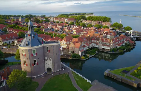
Enkhuizerzandroute - Ontdek de randen van Enkhuizen
Walk along the IJsselmeer, through the Streekbos and over the city walls of Enkhuizen - an 8.9 km circular walk full of variety.
- Start location
- Enkhuizen
- Distance
- 8.9 km
-
Noordzeewandeling Schoorlse Duinen – 10 km door duin, heide en strand
Walk 10 km through the Dunes of Schoorl: climb the highest dune staircase, enjoy the heath, Vogelmeer, and the North Sea beach. A varied ranger trail adventure!
- Start location
- Schoorl
- Distance
- 10.6 km
-
Spaarneroute – Wandelen langs het Spaarne in Haarlem
Walk 13.8 km along the Spaarne in Haarlem: from Schoteroog via De Adriaan Mill and the Gravestenenbrug, back via the quiet Parkwijk to the Veerplas.
- Start location
- Haarlem
- Distance
- 13.8 km
-
Landgoed Groeneveld
From Baarn station, you are at Landgoed Groeneveld in no time: a romantic country estate with ponds, bridges, winding paths, and a castle with hospitality and exhibitions.
- Start location
- Baarn
- Distance
- 15.7 km
-
Kennemerduinen
Walk 15.8 km through the Kennemerduinen, from Santpoort-Noord to Overveen or Zandvoort, a varied NS walking route through the coast and dunes.
- Start location
- Santpoort-Noord
- Distance
- 15.8 km
-
Gein en Vecht
You start in Abcoude and discover two idyllic rivers in one route: the Gein and the Vecht. They have much in common. They meander through a quintessentially Dutch landscape brimming with culture and history.
- Start location
- Abcoude
- Distance
- 13.7 km
-
Helderse Duinen
Those traveling to Den Helder are rewarded with a surprising route. From winding dune paths to the dead-straight Wadden Sea dike.
- Start location
- Den Helder
- Distance
- 16.1 km
-
Amsterdam via Westerborkpad
A fascinating city walk through the heart of Amsterdam with a special theme: the persecution of Jews in WWII.
- Start location
- Amsterdam
- Distance
- 10.6 km
-
Kanoroute Spaarne & Mooie Nel
How wonderful is it to explore the Amsterdam Defence Line from the water? Jump in your canoe or on your SUP and paddle around Haarlem.
- Start location
- Haarlem
- Distance
- 20.1 km
-
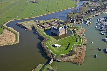
Kanoroute Naarden-Vesting & Oud Naarden
Step into your canoe and explore the fortified city of Naarden from the water. You will paddle along the moats, past Fort Ronduit, and afterwards it is also possible to explore the Zanderijvaart.
- Start location
- Naarden
- Distance
- 16.0 km
-
Busch en Dam en Krommenie
While canoeing, various parts of the Amsterdam Defence Line are still visible here.
- Start location
- Krommenie
- Distance
- 5.0 km
-
De Bretten
Stroll through a green wilderness full of plants and animals, while railway lines and highways are still nearby.
- Start location
- Halfweg
- Distance
- 9.7 km
-
Kanoën over de Vecht
For centuries, the Vecht was important to the Dutch Water Lines. For the northern part of the defense lines, the river formed the backbone that supplied the water to inundate the surrounding areas.
- Start location
- Muiden
- Distance
- 41.0 km
-
Vaarrondje rond Krommeniedijk - Uitgeest
A pleasant boating route through a nature-rich area with historical elements, ideal for a relaxing day on the water with family or friends.
- Start location
- Uitgeest
- Distance
- 9.0 km
-
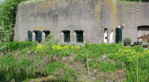
Fortenland kanoroute
An adventurous 22 km canoe route through 't Kalf in Zaanstad, where you enjoy forts, windmills, and the green surroundings.
- Start location
- Muiden
- Distance
- 22.0 km
-
Uitgeestermeer route
Step into your canoe or boat and explore the beautiful Uitgeestermeer. Along the way, you will see various remnants of the Defence Line of Amsterdam.
- Start location
- Uitgeest
- Distance
- 5.5 km
-
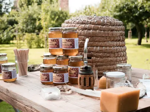
Streekproductenroute door De Beemster
The Regional Products Route through De Beemster invites you on a tasty cycling discovery tour through the UNESCO World Heritage Site of De Beemster. You will cycle through the characteristic reclaimed land landscape and past various farm shops and stalls, where you can sample delicious local products. From fresh dairy and artisanal cheeses to juicy fruit and pure honey – this route is a feast for your senses!
- Start location
- Purmerend
- Distance
- 29.0 km
-
Gouwzeeroute
Cycle past swaying reeds, the ring canal surrounding the De Purmer polder, and through charming towns that once lay on the Zuiderzee. The Gouwzee Route is a varied tour that takes you through the vast polder landscape and along the shimmering waters of the Gouwzee.
- Start location
- Purmerend
- Distance
- 33.2 km
-
De Zeevangroute – Fiets door Laag Holland
Hop on your bike and let yourself be surprised by the unique Zeevang Route, an adventurous 34-kilometer tour through the special landscape of Laag Holland. This route takes you below sea level, through historic polders and past picturesque ribbon villages, allowing you to experience how people and water have coexisted here for centuries. You will discover the rich history of this area, from the battle against the water to the defense of Amsterdam, and enjoy the peace and nature so characteristic of the Kop van Noord-Holland.
- Start location
- Middelie
- Distance
- 34.0 km
-

Recreatief en historisch Oostzaan
This route takes you past special places that each tell their own story about the history, nature, and art of Oostzaan.
- Start location
- Oostzaan
- Distance
- 16.0 km
-
Fietsen onder de zeespiegel
Cycling through the vast polders of Laag Holland, you pass below sea level to Volendam, Monnickendam, and the island of Marken. This route takes you to the historic city center of Monnickendam, the Paard van Marken, and past the Volendam harbor!
- Start location
- Volendam
- Distance
- 35.0 km
-
Het Voetstappenpad
Walk the iconic Voetstappenpad: 26 km through heathland, forest, and estates around Hilversum. One of the oldest walking routes in the Netherlands.
- Start location
- Hilversum
- Distance
- 26.0 km
-
Culinair Heemskerk
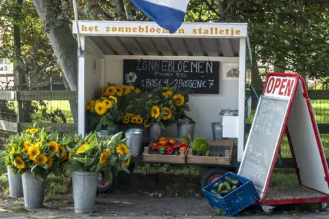
You are walking through the Heemskerk market garden area. Scattered throughout the area, you will find various stalls. Along the way, you can buy fresh flowers, potatoes, vegetables, fruit, herbs, and other seasonal products at one of the many stalls.
- Start location
- Heemskerk
- Distance
- 12.3 km
-
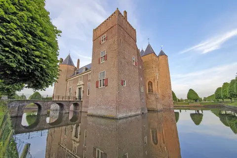
Pareltjes route
This route takes you past two castles, the beautiful castle garden, and through the charming village center with its nice shops and restaurants. During this 14 km walk, you are sure to come across a spot to have a drink or a bite to eat.
- Start location
- Heemskerk
- Distance
- 14.0 km
-
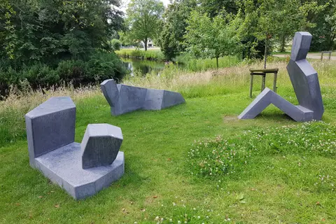
Bankjesparade Heemskerk — Wandeling langs 18 kunstzinnige bankjes
Walk 10.5 km through Heemskerk past 18 unique art benches — a surprising mix of art in public space, nature, and village atmosphere in the IJmond.
- Start location
- Heemskerk
- Distance
- 10.5 km
-
Streekproductenroute Purmerend–Beemster
Start in Purmerend and cycle 29 km through De Beemster, past farm shops, cheesemakers, fruit orchards, and honey. Discover the tastiest regional products of North Holland!
- Start location
- Purmerend
- Distance
- 29.0 km
-
Toekomstbestendige boeren in Amsterdam Noord
Discover the peat meadow area of Landelijk Noord on this 33 km cycling route. Learn about land subsidence, regional products, and future-proof farming. Start at Amsterdam Noord metro station.
- Start location
- Amsterdam
- Distance
- 33.0 km
-
Aeën en Dieënroute – Fietsroute door Waterland-Oost
Discover the open peat meadow landscape of Waterland-Oost by bike. Past ribbon villages, meadow birds, and the Markermeer.
- Start location
- Waterland
- Distance
- 30.4 km
-
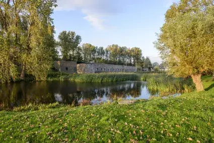
Groene Stellingroute De Beemster
Start in Purmerend and cycle 52.5 km past seven forts of the Amsterdam Defence Line in the green Beemster landscape. Discover UNESCO heritage sites, polders, and historic villages.
- Start location
- Purmerend
- Distance
- 52.5 km
-
Ode aan het schilderachtige Laag Hollandse Landschap
Start in Zaandam and cycle 92 km through North Holland in the footsteps of Monet, Signac, and Toorop. Picturesque villages, windmills, polders, and museums await you!
- Start location
- Zaandam
- Distance
- 92.0 km
-
Fietsroute Weidevogels Wormer- en Jisperveld
Cycle 27 km through the largest peat meadow area in Western Europe. Spot black-tailed godwits, lapwings, and redshanks. Start and end at Tramplein bus station in Purmerend.
- Start location
- Purmerend
- Distance
- 27.0 km
-
Laarzenpadroute Naardermeer door moerasbos en hooiland
Short 5.5 km walk near Naarden and Bussum: over boardwalks through soggy swamp forest and past picturesque hay meadows by the Naardermeer.
- Start location
- Naarden
- Distance
- 5.5 km
-
Natuurbrugroute Zanderij Crailoo
Circular walk of 7.1 km from Bussum-Zuid station past heathland, Spanderswoud and Europe's longest ecoduct — Zanderij Crailoo (800 m).
- Start location
- Bussum
- Distance
- 6.9 km
-
Rondje Lage Hoek - Wandeling vanuit De Weijver bij Opmeer
8.5 km circular walk through the West Frisian polders near Opmeer and Hoogwoud, past the national monument Wipbrug and polder mill De Vier Winden.
- Start location
- Hoogwoud
- Distance
- 8.5 km
-
Uiterdijkroute - Wandeling langs Markermeer en Schellinkhout
Walk along the historic West Frisian Ring Dyke with wide views of the Markermeer and through the picturesque village of Schellinkhout — 7.8 km.
- Start location
- Schellinkhout
- Distance
- 7.8 km
-
Langereisroute - De Weijver via Groene Pade
18.7 km circular walk through the West Frisian polder landscape, past meadow birds, a historic wading pool, and the Groene Pade water reservoir in Hoogwoud.
- Start location
- Hoogwoud
- Distance
- 18.7 km
-
Grote Zomerdijkroute
Short circular walk of 5.1 km through the quiet farmland around Spanbroek — with views of the fan-shaped polder landscape of West Friesland.
- Start location
- Spanbroek
- Distance
- 5.1 km
-
Ommetje Spanbroek-Opmeer
Quiet village walk of 6.6 km through Spanbroek and Opmeer – past small parks, the ice rink, and the De Wijzend marina in Westfriesland.
- Start location
- Spanbroek
- Distance
- 6.6 km
-
Monumentale route
This Wormerland Monumental Route leads you past a unique combination of historical monuments, breathtaking landscapes, and cozy eateries.
- Start location
- WORMER
- Distance
- 26.0 km
-
HollandRoute - Industrieel Rood: Amsterdam naar Zaandam
Cycle 32 km past industrial heritage: Westergasfabriek, NDSM Shipyard, Hembrug site, and the North Sea Canal — depart directly from Amsterdam Central or Zaandam.
- Start location
- Amsterdam
- Distance
- 32.0 km
-
Galerieroute
Cycle past five unique galleries and studios in Zaandam — from street art to Monet replicas — and discover the creative side of the Zaan region.
- Start location
- Zaandam
- Distance
- 10.0 km
-
Kanoroute Wormer en Jisperveld
Discover the Wormer- and Jisperveld from the water. By canoe, you paddle between the hundreds of small meadows and enjoy the unique nature teeming with meadow birds.
- Start location
- Wormer
- Distance
- 5.0 km
-
Zaans erfgoed
The Zaanse Schans was officially opened in 1972 as a timber construction reserve and has since grown into a top tourist attraction.
- Start location
- Zaandam
- Distance
- 6.1 km
-
Industrieel erfgoed
The route runs along the water of the Zaan as much as possible. Where factories once stood, residential complexes have now risen that resemble their predecessors in form and volume.
- Start location
- Zaandam
- Distance
- 5.3 km
-
Oosterveld
Explore the enchanting waterways of the Zaan, which take you towards the beautiful Twiske and the Oostzanerveld.
- Start location
- Zaandam
- Distance
- 26.0 km
-
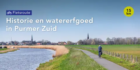
Historie en watererfgoed in Purmer Zuid
It has been four centuries since this polder was drained using polder windmills. Cycle past interesting places, read the stories, and the Purmer comes to life.
- Start location
- Purmerend
- Distance
- 15.0 km
-
Naar het Rijk der Duizend Eilanden - Heerhugowaard
In Heerhugowaard, this walk passes through the headquarters of the Hollands Noorderkwartier Water Board (open during office hours). In a nice informative video, the water board talks about medieval peat reclamation, its consequences for the specific (watery polder) landscape here, and what that means for water management.
- Start location
- Heerhugowaard
- Distance
- 15.0 km
-
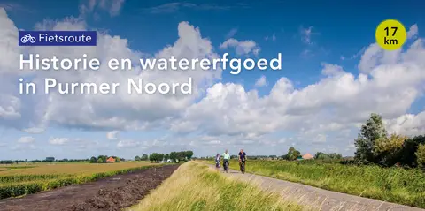
Historie en watererfgoed in Purmer Noord
It has been four centuries since this polder was drained using windmills. Cycle past interesting spots, read the stories, and the Purmer comes to life. Two cycling routes have been mapped out, through the north and the south of the polder.
- Start location
- Purmerend
- Distance
- 17.0 km
-

Ommetje Kwadijkeroog – Rondje door polder en ringdijk
Walk 5.2 km along the southern outer dike edge of Kwadijk, over the Purmer ring dike and past the former station building — a quiet Westfriesland route.
- Start location
- Kwadijk
- Distance
- 5.2 km
-
Tien Bergenroute - Overveen: Van binnenduinrand naar zeereep
You start in Overveen and take a 9 km circular walk through Zuid-Kennemerland National Park, passing dune lakes, viewpoints, and a varied dune landscape — ideal for experienced hikers.
- Start location
- Overveen
- Distance
- 8.3 km
-
Zuiderzeepad etappe 07
Discover Amsterdam. Walk around the IJsselmeer and explore the former Zuiderzee (LAW 8)
- Start location
- Amsterdam
- Distance
- 17.1 km
-
Zuiderzeepad - Etappe 3: Scharwoude - Edam
Start in Scharwoude and walk 16.8 km on the Zuiderzeepad from Scharwoude to Edam through the open polder landscape of Waterland, past historical sites that tell the story of the battle against the water.
- Start location
- Scharwoude
- Distance
- 16.7 km
-
Drommedarisroute
The Drommedaris Route (blue) takes you through the old city centre of Enkhuizen.
- Start location
- Enkhuizen
- Distance
- 5.2 km
-
Batoroute (geel)
The longer Bato Route (yellow) in Velsen-Zuid takes you to the historical site where the Roman harbor fort once stood on the Oer-IJ. The route passes various archaeological points near De Ven in Velsen-Zuid and bridges the gap between Roman history and the natural value of Spaarnwoude Park.
- Start location
- Velsen-Zuid
- Distance
- 5.4 km
-
Boerenommetje
The Boerenommetje (blue) leads through gently rolling grassland. Here it is clearly visible that Oosterend is situated on a somewhat higher moraine.
- Start location
- Oosterend
- Distance
- 4.8 km
-
Koepelbergroute Landgoed Duin en Kruidberg: Koning van het uitzicht
Start in Santpoort-Noord and walk 1.69 km across the Duin en Kruidberg Estate in Zuid-Kennemerland National Park, and climb the Koepelberg for a panoramic view. Discover historical sights and enjoy nature on this short but impressive route.
- Start location
- Santpoort-Noord
- Distance
- 1.7 km
-
Waterliniepad etappe 8: historische charme langs het Gein naar Weesp
Start in Abcoude and walk 13 km past monumental farmhouses along the Gein, and discover the fortified town of Weesp with its impressive Tower Fort on the Ossenmarkt.
- Start location
- Abcoude
- Distance
- 13.0 km
-
Waterliniepad etappe 06: Hoofddorp - Uithoorn
Walk 17.1 km along the vast Westeinder Lakes and historic forts, from Hoofddorp to Uithoorn. Discover the fortifications of the Water Line!
- Start location
- Uithoorn
- Distance
- 17.1 km
-
Waterliniepad etappe 10: Naarden-Bussum - Nederhorst den Berg
Walk 16.7 km past historic forts and enjoy unique birds at the vast Naardermeer in Naarden. Discover the Defence Line of Amsterdam in North Holland.
- Start location
- Naarden
- Distance
- 16.7 km
-
Waterliniepad Etappe 11: Van Loosdrechtse Plassen naar Maarssen
Discover 19 km of the Waterline Trail: along the Vecht, past the country estates and forts of Nederhorst den Berg, via Vreeland and Loenen, to Maarssen. A journey through nature and rich history!
- Start location
- Nederhorst den Berg
- Distance
- 19.0 km
-
Waterliniepad - Etappe 9: Weesp naar Naarden-Bussum
Walk from historic Weesp to Naarden-Bussum (23.6 km) over fortifications and through water-rich nature along the Amsterdam Defence Line.
- Start location
- Weesp
- Distance
- 22.2 km
-
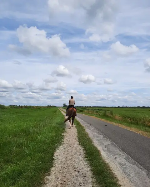
Ruiterroute door het Twiske
Ride on horseback through the Het Twiske recreational area near Oostzaan. Enjoy open polders, reed beds, and quiet bridle paths in the heart of North Holland. This riding route takes you right into the characteristic North Holland polder landscape, rich in water, birds, and sweeping vistas.
- Start location
- Oostzaan
-
Floris V-pad - Etappe 1: Amsterdam Dam naar Weesp
From the canals of Amsterdam via the quiet Weespertrekvaart to Weesp — 17.4 km long-distance walking route full of water, history, and hidden urban tranquility.
- Start location
- Amsterdam
- Distance
- 17.4 km
-
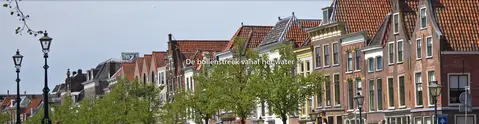
De bollenstreek vanaf het water
Viewing and enjoying the bulb region from the water adds a completely new dimension to the famous Dutch splendor of color.
- Start location
- Leiden
- Distance
- 44.6 km
-
De bollenstreek vanaf het water
Viewing and enjoying the bulb region from the water adds a completely new dimension to the famous Dutch splendor of color.
- Start location
- Leiden
- Distance
- 44.6 km
-
Zuiderzeepad - Etappe 1: Enkhuizen naar Wijdenes
From historic Enkhuizen along the IJsselmeer and Markermeer to tranquil Wijdenes — 17.2 km LAW walk full of West Frisian farmhouse-style buildings and water views.
- Start location
- Wijdenes
- Distance
- 17.2 km
-
Werelderfgoed in het kwadraat
From Purmerend past two UNESCO World Heritage Sites: the Beemster Polder and the Amsterdam Defence Line — a 17.2 km cultural-historical walk full of panoramic views.
- Start location
- Purmerend
- Distance
- 17.2 km
-
Waterliniepad - Etappe 14: Nieuwegein naar Prinses Beatrixsluis
14.5 km walk past Fort Jutphaas and through Park Oudegein, from Nieuwegein to Prinses Beatrixsluis. Discover the Waterline!
- Start location
- Nieuwegein
- Distance
- 14.5 km
-
Waterliniepad - Etappe 10: Naarden-Bussum naar Nederhorst den Berg
From the fortified town of Naarden via the tranquil Naardermeer and the Hilversumse Meent to Nederhorst den Berg — 16.7 km past UNESCO heritage and rare nature.
- Start location
- Naarden
- Distance
- 16.7 km
-
Baafjesroute (rood)
The Baafjes Route (red) runs along a beautiful grassy embankment through the Baafjespolder in Heiloo. Dogs are prohibited.
- Start location
- Heiloo
- Distance
- 2.8 km
-
Rode route vanaf startpunt Centrumwaard
The red route from the Centrumwaard starting point in Heerhugowaard is a nice, short walk that crosses the Middenweg twice and then plunges into the Rosarium. In the park there are a...
- Start location
- Heerhugowaard
- Distance
- 2.9 km
-
Rondje Heilooërbos (geel)
The Rondje Heilooërbos (yellow) is a route for the whole family through the forest of the old Nijenburg estate. At the edge of the forest, you have a wide view over the surrounding meadows. Also...
- Start location
- Heiloo
- Distance
- 4.1 km
-
Groene route vanaf startpunt Heiloo
The Green Route from the Heiloo starting point allows you to discover the old towpaths along the Hoever and Bindervaart canals.
- Start location
- Heiloo
- Distance
- 10.2 km
-
Ommetje Eilandspolder (blauw)
The Eilandspolder Loop begins as a village walk via the Grote Dam in De Rijp (where it all began), the Tuingracht (the first harbor), and the Rechtestraat (the oldest street).
- Start location
- De Rijp
- Distance
- 6.8 km
-
Roetroute (zwart)
The Roetroute (5.2 km) through the Dunes in Schoorl is marked with black arrows with the name in white letters. The route passes places where the dune forest has burned and nature has beautifully...
- Start location
- Schoorl
- Distance
- 5.3 km
-
Blauwe route vanaf startpunt 't Kruis
The route through Heerhugowaard combines the old Middenweg with the new Waarderhout. Staatsbosbeheer planted the Waarderhout with fast-growing poplars in the late 20th century, to compensate for the...
- Start location
- Heerhugowaard
- Distance
- 8.3 km
-
De Klaas Hoorn- en Kijfpolderroute (blauw)
Walk this short but very beautiful circular walk through the Klaas Hoorn and Kijfpolder and along the shores of the Alkmaardermeer near Akersloot. The polder is a typical Dutch peat meadow area with...
- Start location
- Akersloot
- Distance
- 2.7 km
-
Grootschermerroute
The Grootschermer route circles the northern part of the Eilandspolder, a water-rich nature reserve managed by Staatsbosbeheer with long, narrow, partly overgrown peat plots. You walk along green church paths...
- Start location
- Grootschermer
- Distance
- 10.7 km
-
Boomplanterstocht (groen)
The green-marked Boomplanterstocht is a circular walk through the dunes in Schoorl. This route passes through the oldest forests of the dune area.
- Start location
- Schoorl
- Distance
- 11.6 km
-
Gele route vanaf Startpunt 't Kruis
The route in Heerhugowaard is a short walk through the Waarderhout. Since the forest has been redeveloped, you can enjoy a lovely stroll there. Please note: some paths may be muddy.
- Start location
- Heerhugowaard
- Distance
- 3.0 km
-
Paarse route vanaf startpunt Stad van de Zon
The route combines Park van Luna and the Huygendijkbos with the Schermer Ringvaart in Heerhugowaard. You walk along many unpaved paths, including a beautiful grassy embankment.
- Start location
- Heerhugowaard
- Distance
- 8.3 km
-
Paarse route vanaf startpunt Heiloo
The Purple Route from the Heiloo starting point is a long circular walk through the greenery in and around Heiloo. The route goes through the Heiloo Forest of Natuurmonumenten, via the center of Heiloo to the Chapel...
- Start location
- Heiloo
- Distance
- 12.8 km
-
Noordzeewandeling (blauw)
The blue-marked North Sea Walk is a circular walk through the dunes in Schoorl. This route takes you to the sea. Tip: in the month of August, the heather is in bloom. You then walk through a sea...
- Start location
- Schoorl
- Distance
- 10.6 km
-
Ommetje Overdie
The route is a longer circular walk through the Oosterhout, the Westerhout, and the Boekelermeer in Heiloo.
- Start location
- Heiloo
- Distance
- 9.0 km
-
Ommetje Noordeindermeer (groen)
Along the Noordeindermeer Loop, the Arisdijk offers a striking contrast between the medieval plots around Lake Arismeer in the west and the low, straight polder blocks of the Noordeindermeer in Driehuizen.
- Start location
- Driehuizen
- Distance
- 6.0 km
-
Noord-Hollandpad - Etappe 2 De Waal - Den Helder
The second stage of the North Holland Trail starts in De Waal, the smallest village on Texel with fewer than 300 inhabitants. It used to be situated by the sea. The draining of the Waal en Burg polder meant that De Waal now lies on the border between the old and new land of Texel. In this picturesque village, you will find a friendly atmosphere, narrow streets, old cottages, and farms.
- Start location
- De Waal
- Distance
- 19.0 km
-
Paarse route vanaf startpunt Hondsbossche Zeewering
The purple route runs around De Putten, a vast meadow area with ditches and ponds, managed by Natuurmonumenten. The name comes from the clay pits that were dug for clay extraction in Castricum.
- Start location
- Castricum
- Distance
- 3.5 km
-
Ziltepad - Wieringerwaard - Westerland
An intriguing walk through the polder landscape from Wieringerwaard to the former island of Wieringen, with panoramic views and stories of the struggle against the water.
- Start location
- Wieringerwaard
- Distance
- 11.7 km
-
Ziltepad - Westerland - Stroe
Discover the rich history of Wieringen, from Viking chatting to the story of the German Crown Prince, during this fascinating route along the Wadden Sea. Full of history and beautiful vistas!
- Start location
- Westerland
- Distance
- 11.9 km
-
Ziltepad - Stroe - Oosterland
Discover Wieringen: an intimate walking paradise of 21 km along Wadden dikes, historic duck decoys, and the NieuwlandWaard polder. Spot kingfishers and explore a unique landscape.
- Start location
- Hippolytushoef
- Distance
- 20.5 km
-
Ziltepad - Anna Paulowna - Wieringerwaard
From Anna Paulowna to Wieringerwaard, on Het Ziltepad, you follow the centuries-old traces of a medieval tidal channel in the varied polder landscape.
- Start location
- Anna Paulowna
- Distance
- 16.3 km
-
Ziltepad - Huisduinen - Anna Paulowna
Discover 25 km of surprising landscape variety from the North Sea coast, through green forests and flower bulb fields, to the serene polder of Anna Paulowna.
- Start location
- Huisduinen
- Distance
- 19.4 km
-

Ziltepad - Den Helder - Huisduinen
Discover Willemsoord in Den Helder, the former Royal Navy shipyard that is now a vibrant open-air museum and entertainment center. Explore the rich maritime history and impressive architecture.
- Start location
- Den Helder
- Distance
- 13.5 km
-
Amsterdamse Bos en Schinkelbos
The route starts and ends in the Old Village, where you can have lunch or grab a drink on a terrace afterwards.
- Start location
- Amstelveen
- Distance
- 9.9 km
-
Historische route: Stad in de Polder
Explore the history of the Amstelveen polders during this bike tour through Groenelaan, Waardhuizen, and the village of Nes aan de Amstel. This part of Amstelveen originated in what was formerly known as the Bovenkerkerpolder. Many traces can still be found in the landscape and buildings that tell the history of Amstelveen.
- Start location
- Amstelveen
- Distance
- 13.0 km
-
Fietsroute Amsterdamse Bos
Explore the Amsterdamse Bos by bike! From Scottish Highlanders and goats to the tranquil Blossom Park and Schinkelbos – this diverse route starts in Amstelveen and takes you past the animals and beautiful nature of the Amsterdamse Bos.
- Start location
- Amstelveen
- Distance
- 20.0 km
-
Rond de Amstel fietsroute
This bike tour takes you past farmhouses and beautiful viewpoints over the bends of the Amstel. Along the way, there are plenty of opportunities to stop for a cup of coffee or an ice cream. Start on the Amstelveen side of the Amstel and take the ferry halfway to the other side.
- Start location
- Amstelveen
- Distance
- 21.0 km
-
Drie Heemparken Route
Picturesque walking paths wind through trees, shrubs, and herb beds into open spaces. Discover the Heemparks of Amstelveen on this beautiful route through nature.
- Start location
- Amstelveen
- Distance
- 2.8 km
-
Trekvogelpad - Etappe 1: Bergen aan Zee naar Alkmaar
Van Noordzeestrand via duinen en polder naar de historische vestingstad Alkmaar — 21,7 km LAW-wandeling vol landschapsvariatie.
- Start location
- Bergen aan Zee
- Distance
- 21.7 km
-
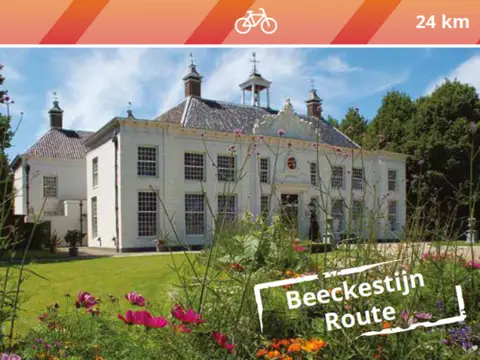
Fietsroute Beeckestijn
The South Kennemerland region, between IJmuiden and Haarlem, is characterized by a dune landscape, villa villages, and estates.
- Start location
- Velsen-Zuid
- Distance
- 24.0 km
-
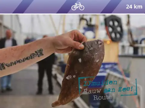
Fietsroute IJmuiden Rauw aan Zee
Discover the raw character of IJmuiden, the harbour, the beach, and the lock complex where the largest sea lock in the world is located.
- Start location
- Velsen-Zuid
- Distance
- 24.0 km
-
Fietsroute Texel & de Texelaar
Visit Wadden has mapped out the food cycling route 'Texel & de Texelaar'. With this route, you explore the island by bike, but also its culinary delights.
- Start location
- Den Burg
- Distance
- 64.0 km
-
Wandelroute Strandvlaktes en duinvalleien
Walk along the Geul with the bird-rich Geulplas, and then enjoy a breath of fresh air on the beach.
- Start location
- Den Hoorn
- Distance
- 6.8 km
-
Fietsroute Lammetjesroute
On Texel, spring announces itself in an endearing way. With thousands of woolly, bleating lambs on Texel sheep farms and in the meadows.
- Start location
- Den Burg
- Distance
- 35.0 km
-
Fietsroute Rondje Texel
Want to discover the whole island in one day by bike? This 65-kilometer cycling route is perfect for seeing the best of Texel in one day!
- Start location
- Den Burg
- Distance
- 65.0 km
-
Wandelroute Sommelpaadje
This walk follows the Sommelpaadje, a walking path near the village of De Waal. It takes you past turf walls and sheep pastures, across the oldest part of Texel. You will also pass the Waalenburg polder.
- Start location
- Oudeschild
- Distance
- 3.0 km
-
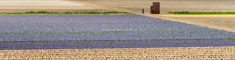
Bollenstreek route
Discover the colorful heart of the Bulb Region from the water. This varied boat route takes you past blooming fields, unique villages, and the lake area around Warmond and the Kaag.
- Start location
- Beinsdorp
- Distance
- 33.0 km
-
Amsterdam Haarlem
An atmospheric journey between two historic cities. Enjoy windmills, villages, and typical Dutch vistas.
- Start location
- Amsterdam
- Distance
- 58.9 km
-
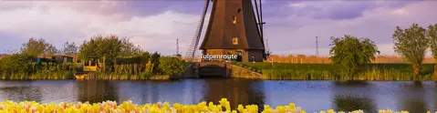
Tulpenroute
Follow the 2-hour Tulip Route along the stories. Discover the colorful polders surrounding Roelofarendsveen, where tulip fields, waterways, and local history come together. This route takes you through the heart of the flower region, an atmospheric journey full of nature, culture, and surprising views.
- Start location
- Roelofarendsveen
- Distance
- 6.7 km
-
't Gooi met de fietsboot - de Eemlijn
Discover Eemland and 't Gooi by bike and bike boat. Start in Huizen and walk, cycle, and relax on board. You can board and disembark at one of the boarding points of your choice. If you are traveling with a bicycle, we will place it on the lower deck and return it to you at your disembarkation point. Huizen
- Start location
- Huizen
-
Ziltepad - Rondwandeling Stroe
The hand of sea and ice that kneaded and shaped Wieringen is visible to anyone who looks around. Stroe is...
- Start location
- Hippolytushoef
- Distance
- 15.5 km
-
Kunstroute 'De schilders van Laren & Blaricum'
Famous painters such as Piet Mondrian and Anton Mauve were inspired by the beautiful surroundings of the villages of Laren and Blaricum. Where did they live and work? And where did they find inspiration for their – now famous – paintings?
- Start location
- Laren
- Distance
- 5.5 km
-
Vuurlijnpad
The Vuurlijnpad from Aalsmeer is a challenging loop starting from the Westeinderplassen via the Vuurlijn. This earthen dike was part of the Stelling van Amsterdam, the defensive line around the capital.
- Start location
- Aalsmeer
- Distance
- 17.9 km
-
LF Zuiderzee Route | Medemblik - Workum
Between Medemblik and Den Oever, the landscape looks very different. Here you cycle through the Wieringermeerpolder, the only true Zuiderzee polder. It was drained in 1930, before the Afsluitdijk existed. Near Den Oever, you pass through the first of the few patches of forest on this route. The Dijkgatbos was planted after the Germans blew two holes in the dike of the newly constructed polder just before their retreat in 1945.
- Start location
- Medemblik
- Distance
- 70.0 km
-
LF Zuiderzee Route | Hoorn - Medemblik
The first West Frisian city you encounter today is Hoorn. At the beginning of the Eighty Years' War, Hoorn was briefly the most important trading city in Holland. This was because Amsterdam initially sided with the Spaniards, while many cities rallied behind the Revolt. The Zuiderzee cities, together with the Sea Beggars, blockaded the port of Amsterdam. At Hoorn, this escalated into the Battle of the Zuiderzee between the Spanish fleet and the rebels. Past the Binnenhaven, on the Bossuhuizen, you can see colorful friezes depicting the Battle of the Zuiderzee
- Start location
- Hoorn
- Distance
- 49.0 km
-

Stierop route
Explore Lake Uitgeest, the Stierop stream, Fort Marken-Binnen, and Fort Krommeniedijk during this beautiful canoe route through the greenery.
- Start location
- Uitgeest
- Distance
- 11.0 km
-
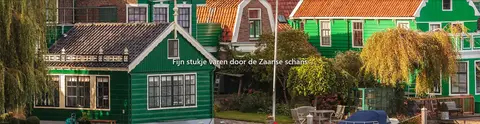
Fijn stukje varen door de Zaanse schans
Windmills, the vastness of the landscape, and the preserved wooden houses, barns, and warehouses from earlier times, characteristic of the Industrial Revolution of the 19th century, form the backdrop of the route.
- Distance
- 26.8 km
-
LF Zuiderzee Route
From Amsterdam, within ten minutes you can cycle from a busy early 20th-century residential area, over the Schellingwoude Bridge and under the ring road, to the tranquility of the countryside. Near Durgerdam, you get a good view of the water around which this route revolves. The area you cycle through is called Waterland.
- Start location
- Amsterdam
- Distance
- 53.0 km
-
Sloepenronde de Wijde Blik & de Vecht Zuid
Ready for a wonderful day on the water of the Loosdrecht Lakes and the Vecht?
- Start location
- Kortenhoef
- Distance
- 20.3 km
-
Rondje Wijde Blik langs de eilanden
Navigation route for canoes, sailboats, rowboats, and motorboats along mooring points on the shore and various small islands on the Wijde Blik.
- Start location
- Kortenhoef
- Distance
- 5.9 km
-
Fortenland fietsroute
This route takes you past seven forts in Gooi & Vecht that are all part of the UNESCO World Heritage Dutch Waterlines.
- Start location
- Muiden
- Distance
- 34.0 km
-
Noord-Hollandpad - Etappe 14 Ouderkerk aan de Amstel - Abcoude
Stage 14, one of the longer stages of the North Holland Trail, is located in the heart of the Green Heart of the Netherlands. Do not set off too late, as you will need your time. The route not only passes straight through one of the busiest areas of the Netherlands—which you won't notice at all, by the way—but there is also plenty to see and discover along the way.
- Start location
- Amstelveen
- Distance
- 24.0 km
-
Noord-Hollandpad - Etappe 15 Abcoude - 's Graveland
This stage is never boring. To start with, in Abcoude you can choose the new route to Nederhorst den Berg or the old route via Baambrugge and Vreeland. Both routes take you to the Ankeveense Plassen. Along the way, you will encounter all sorts of things: winding rivers, a brand-new cycle bridge, cozy terraces, a ferry, and yes, it is true, you will also walk through the province of Utrecht for a brief moment.
- Start location
- Abcoude
- Distance
- 17.0 km
-
Noord-Hollandpad - Etappe 16 's-Graveland - Huizen
You have arrived at the final stage of the North Holland Trail. Or the first, if you are walking the route from south to north. In both cases, it is a milestone: you have almost made it, or you are at the beginning, ready to discover something new. The walk from 's-Graveland to Huizen is special in any case. Here, there are no Dutch polders, but shady forests and rolling heathlands in the middle of 't Gooi. With the Tafelberg as the literal summit.
- Start location
- 's-Graveland
- Distance
- 15.0 km
-
Noord-Hollandpad - Etappe 11 Akersloot - Krommenie
For bird lovers, this is an ideal stage. It runs straight through one of the most bird-rich parts of North Holland. The pools along the route are often bustling with activity, and in winter, thousands of wigeon sometimes fly over. It is fortunate that the stage is not too long. Now you have plenty of time to spot the meadow birds at your leisure and to enjoy the scenery, because even if you are not here for the birds, it is a pleasant walk.
- Start location
- Akersloot
- Distance
- 15.0 km
-
Noord-Hollandpad - Etappe 7 De Haukes - Kolhorn
From De Haukes, you walk back to Kolhorn, which is an important junction in the upper part of the Noord-Hollandpad. However, it would be a shame not to incorporate the special atmosphere of the former island of Wieringen into the Noord-Hollandpad. That is why a branch (stages 6 and 7) runs here to and from Kolhorn.
- Start location
- Westerland
-
Noord-Hollandpad - Etappe 12 Krommenie - Halfweg
This long stage—25 km is no small feat—is one of extremes. Here, you encounter not only grassy dikes, shell paths, and narrow dike roads, but you also walk through the prehistoric Oer-IJ, past remnants of the Amsterdam Defence Line and the North Sea Canal. And if that isn't enough, this stage takes you right into the heart of the Randstad, with planes flying to and from Schiphol overhead.
- Start location
- Krommenie
- Distance
- 25.0 km
-
Noord-Hollandpad - Etappe 13 Halfweg - Ouderkerk aan de Amstel
You might not realize it immediately, but with this stage, you are actually walking along the southern borders of the big city of Amsterdam. It used to be busy around Halfweg, but peace returns now as you pass through the Tuinen van West and Lutkemeerpark. It is also lovely to walk on the grassy dike along the ring canal of the Haarlemmermeer. The planes are still there, but Amsterdam also has plenty of greenery, and this walking route to Ouderkerk aan de Amstel proves it. City and nature alternate continuously.
- Start location
- Halfweg
- Distance
- 25.0 km
-
Noord-Hollandpad - Etappe 10 Schermerhorn - Akersloot
This stage also offers plenty of variety. Here you walk through the Land of Leeghwater. As the Dutch, we are proud of the technical knowledge with which we do battle with the water. The polders of De Beemster and De Schermer, drained during the Golden Age, are fine examples of this. Along the way, therefore, you will encounter many straight roads, ditches, canals, and typical Dutch skies. Additionally, it is a stage passing through many village centers with cozy places to eat and drink.
- Start location
- Schermerhorn
- Distance
- 15.0 km
-
Noord-Hollandpad - Etappe 8 Kolhorn - Obdam
Kolhorn lies amidst the meadows. If you look closely at the picturesque location of this small village behind the dike, you can easily imagine that Kolhorn used to be situated on the Zuiderzee. Since the land reclamation, the former fishing village lies in the heart of the West Frisian landscape and has a protected village appearance.
- Start location
- Kolhorn
- Distance
- 22.0 km
-
Noord-Hollandpad - Etappe 9 Obdam - Schermerhorn
This short but exhilarating stage is a mix of pleasant, quiet country lanes and unpaved church paths, of straight canals and winding ditches, peat meadows and grassy dikes with plenty of stiles. And of windmills, for here you are surrounded by many reclaimed lands where, in the 17th century, entire windmill parks created new land. You walk below sea level in this region, hence the name Laag-Holland (Low Holland).
- Start location
- Obdam
- Distance
- 13.0 km
-
Noord-Hollandpad - Etappe 5 Wieringerwaard - Kolhorn
This stage is the shortest of the North Holland Trail. From Wieringerwaard—a typical North Holland village with a white church, monumental farmhouses, and a 50-meter-high old water tower—it is only 10 kilometers to Kolhorn, an old fishing village that used to lie on the Zuiderzee. Here, you are constantly on the border between old and new land.
- Start location
- Wieringerwaard
- Distance
- 10.0 km
-

Noord-Hollandpad - Etappe 6 Den Oever - De Haukes
With this stage, we make a brief leap to the other end of North Holland. To Den Oever, where the Afsluitdijk is located—the dike between North Holland and Friesland that separates the IJsselmeer from the Wadden Sea. Here, you walk straight across the former island of Wieringen, with its quintessential Dutch nature and panoramic views.
- Start location
- Kolhorn
- Distance
- 13.0 km
-
Noord-Hollandpad - Etappe 4 Julianadorp - Wieringerwaard
Lisse has the reputation, but the largest fields of flower bulbs are located in the northernmost part of North Holland. Spring is a beautiful time to explore this stage. Some farmers have opened their paths to walkers. Consequently, the North Holland Trail runs straight through the bulb fields.
- Start location
- Julianadorp
- Distance
- 13.0 km
-
Ziltepad - Etappe Oosterland - Stroe
For a long time, Wieringen was the smallest Wadden Island, about ten kilometers long and two to three kilometers wide. After the closure of sea inlets, the reclamation of the Wieringermeer, and the construction of the Afsluitdijk, the island became encapsulated within the mainland.
- Start location
- Den Oever
- Distance
- 18.8 km
-
Noord-Hollandpad - Etappe 3 Den Helder - Julianadorp
Den Helder is located at the very tip of the northernmost point of North Holland. You can easily spend a whole day at this most important naval base in the Netherlands. The history here dates back to Napoleon, who had four large forts built just before he was exiled to Elba. You can still visit this Den Helder Defence Line.
- Start location
- Den Helder
- Distance
- 16.0 km
-
Ziltepad - Etappe Oosterland - Stroe
For a long time, Wieringen was the smallest Wadden Island, about ten kilometers long and two to three kilometers wide. After the closure of sea inlets, the reclamation of the Wieringermeer, and the construction of the Afsluitdijk, the island became encapsulated within the mainland.
- Start location
- Den Oever
- Distance
- 18.8 km
-
Culinaire route Heemskerk
The Heemskerk Culinary Route introduces you to the countryside surrounding this green village.
- Start location
- Heemskerk
- Distance
- 12.3 km
-
IJmondpad
This three-day walking route in the IJmond region allows you to experience culture and nature up close. The IJmondpad connects the characteristic landscapes of the municipalities of Heemskerk, Velsen, Beverwijk, and Castricum.
- Start location
- Castricum
- Distance
- 77.2 km
-
LAW Nederlands Kustpad etappe 8a: Driehuis – Castricum
Walk 13 km through the quiet dunes of the North Holland Dune Reserve. From Driehuis to Wijk aan Zee, past butterflies, dune valleys, and the Kruisberg lookout tower to Castricum.
- Start location
- Driehuis
- Distance
- 25.6 km
-
Noordschermerroute
The Noordschermer Route first runs past three windmills at the end of the Noordervaart in Leiden.
- Start location
- Leiden
- Distance
- 13.8 km
-
Groot-Frieslandpad, etappe 2
"To be honest, we hadn't expected these hidden beauties in Dirkshorn. We cross a lovely little woodland and get a breathtaking view from the steel lookout tower of Nuwendoorn Castle."
- Start location
- Dirkshorn
- Distance
- 16.7 km
-
Wimmenummerpolderroute
The route takes you along the Hoevervaart to the beautiful Wimmenummerpolder. The village of Wimmenum already existed in the tenth century. You also pass the former Carmelite monastery on the Herenweg in Egmond aan den Hoef.
- Start location
- Egmond aan den Hoef
- Distance
- 7.3 km
-
Oostwouderpolderroute
A beautiful circular walk in De Woude around the Oostwouderpolder and the Kogerpolder, with lovely views over the water, farmland, and old Dutch villages.
- Start location
- De Woude
- Distance
- 5.4 km
-
In de voetsporen van Hilde
In the Footsteps of Hilde is a walk through a part of the village of Castricum with a rich and turbulent past.
- Start location
- Castricum
- Distance
- 3.8 km
-
Heerhugopad (Etappe 2)
Following in the footsteps of Lord Hugo, you walk through varied landscapes and nature reserves, past monumental windmills and many beautiful spots in Heerhugowaard. The markings with the blue and red stickers show the way through the land of the 'Lord Huyge Waert'.
- Start location
- Heerhugowaard
- Distance
- 10.0 km
-
Stuifduinentocht
The white-marked Stuifduinentocht is a circular walk through the dunes in Schoorl. This route passes by places in the dune area where sand is allowed to drift again.
- Start location
- Schoorl
- Distance
- 15.8 km
-
Heerhugopad (Etappe 1)
Following in the footsteps of Lord Hugo, you walk along the outskirts of Heerhugowaard, through varied landscapes and many beautiful spots. The markings with the blue and red stickers show the way through the land of the 'Lord Huyge Waert'.
- Start location
- Heerhugowaard
- Distance
- 6.9 km
-
Rondje Rekerhout
This short route shows you the nicest spots in the Rekerhout in Alkmaar. The herb garden and the petting zoo are included in the route.
- Start location
- Alkmaar
- Distance
- 2.9 km
-
Dorregeesterpolderroute (rood)
The Dorregeesterpolder Route (red) runs along the shores of Lake Uitgeest in Uitgeest. From the viewpoint close to the route, you have a beautiful view of the lake. At the wetland area, you can choose...
- Start location
- Uitgeest
- Distance
- 6.2 km
-
Noordkustroute
Enjoy the view over an impressive 17th-century mill park in Schermerhorn: three series of lower, middle, and upper mills that were used to pump the water from the Schermerpolder into the ring canal.
- Start location
- Schermerhorn
- Distance
- 3.4 km
-
Haring- & Henneproute / Kerkepad
This route along centuries-old church paths through the Eilandspolder starts in De Rijp. In the Golden Age, this was a prosperous village thanks to herring fishing, whaling, trade, and shipbuilding.
- Start location
- De Rijp
- Distance
- 13.2 km
-
Veenhuizer Molenroute – Wandel langs historische molens
Discover three historic windmills on this peaceful 7.2 km circular walk along grassy embankments and old lanes in the polder near Heerhugowaard.
- Start location
- Heerhugowaard
- Distance
- 7.2 km
-
Maer- of Korendijkroute
Walking along the edge of the dunes and around the Castricummer Polder, you pass through a rustic part of the village to the center of Castricum. The old Breedeweg with its monumental farmhouses is a reminder of...
- Start location
- Castricum
- Distance
- 7.1 km
-
Heerhugopad (Etappe 3)
Following in the footsteps of Lord Hugo, you walk through varied landscapes and nature reserves, past monumental windmills and many beautiful spots in Heerhugowaard.
- Start location
- Heerhugowaard
- Distance
- 9.5 km
-
Eilandspolder
This circular walk from Spijkerboor goes through the famous village of De Rijp, Noordeinde, Driehuizen, and West- and East-Graftdijk. You also walk along the dikes of De Schermer and De Westbeemster.
- Start location
- Westbeemster
- Distance
- 19.0 km
-
Landgoederenroute Heiloo
The Estates Route (sea green) in Heiloo connects the three estates: Willibrordus, Ter Coulster, and Nijenburg.
- Start location
- Heiloo
- Distance
- 7.4 km
-
Walvisroute: de Rijp naar UNESCO-polder de Beemster
From historic De Rijp through the geometric polder landscape of UNESCO World Heritage Site De Beemster — a walk full of cultural history in West Friesland.
- Start location
- De Rijp
- Distance
- 7.9 km
-
Heerhugopad
Following in the footsteps of Lord Hugo, you walk past hidden spots that many, even many, residents of Heerhugowaard probably do not yet know about. There is plenty to experience along the Heerhugopad. For young and old. For...
- Start location
- Heerhugowaard
- Distance
- 26.4 km
-
LAW Nederlands Kustpad, etappe Groet - Egmond aan Zee
Texel has mapped out a 6-kilometer walking route that allows you to fully enjoy the Zaandijk landscape.
- Start location
- Zaandijk
- Distance
- 20.9 km
-
Landgoederenroute Heiloo (zeegroen)
The Estates Route (sea green) in Heiloo connects the three estates: Willibrordus, Ter Coulster, and Nijenburg. Along the way, you cross the small river Heilooër DIE and pass an old...
- Start location
- Heiloo
- Distance
- 7.6 km
-
Menningweerroute
On the Menningweer Route, the Kopdammerdijk offers a striking contrast between the old, reed-fringed grassland of the Menningweer in the north of Grootschermer (contained in the Eilandspolder in 1825) and the lower-lying land.
- Start location
- Grootschermer
- Distance
- 6.7 km
-
Rode lunchwandelroute, zuidelijk deel
The route runs partly along the footpaths of the Berenkoog and partly through the park strip. You pass Hortus Alkmaar at the Berenkoog.
- Start location
- Alkmaar
- Distance
- 2.1 km
-
Broekerdijkroute (geel)
The walking route consists of a short loop along paved (cycle) paths beside the Alkmaar (Omval)-Kolhorn Canal and starts in Broek op Langedijk. On the eastern side of the canal, you walk along the Westdijk of Broekhorn.
- Start location
- Broek op Langedijk
- Distance
- 4.1 km
-
Rode route vanaf startpunt Alkmaar Noord Station
The route is a short circular walk through the Oudorperhout near Alkmaar, a unique piece of meadow landscape designated as a nature reserve. You cross the beautiful, cobblestone-paved Munikenweg, which...
- Start location
- Alkmaar
- Distance
- 3.6 km
-
Bosrijk Alkmaar
This green city walk through Alkmaar goes through Oosterhout Park, via the ramparts of the historic inner city, to Westerhout and the Alkmaarder Hout. The construction of these 'wooden' forests began around 1600...
- Start location
- Alkmaar
- Distance
- 5.6 km
-
Oude jaagpadroute
The Old Towpath Route (green) runs through the forests of Alkmaar and Heiloo, and through the open landscape of the Egmondermeer, where you discover the old towpaths along the Hoever and Bindervaart canals.
- Start location
- Heiloo
- Distance
- 10.2 km
-
Noord-Hollandpad
Het Noord-Hollandpad is een langeafstandswandelpad langs water, duinen, schapen, bloembollen, historische dorpen, molens, gemalen, boerenlandpaden, dijken, slootjes, trekpontjes en heide. Eigenlijk...
- Start location
- De Cocksdorp
- Distance
- 178.8 km
-
Wandelroute door de Eierlandse Duinen
The Eierland Dunes are located in the north of Texel. The defining feature of this area is, of course, the red lighthouse. That is why this route is also known as the Lighthouse Route. But you can also enjoy excellent birdwatching here in De Cocksdorp!
- Start location
- De Cocksdorp
- Distance
- 6.0 km
-
Fortenfietsroute langs de Vuurlijn
Looking for an unforgettable bike ride along the beautiful forts of the Amsterdam Defence Line? Take the specially mapped-out Forts Cycle Route along the Line of Fire. The Forts Cycle Route starts in Aalsmeer, after which you cycle via De Kwakel to Uithoorn. Along the Amstel, the turning point is located at Kudelstaart to return to Aalsmeer.
- Start location
- Aalsmeer
- Distance
- 16.2 km
-
SUP- en Kanoroute De Bovenlanden
Do you want to discover special places in and around Aalsmeer that you don't know yet in a canoe or on a SUP board? Then rent a canoe or SUP board and follow this route from Stichting De Bovenlanden.
- Start location
- Aalsmeer
- Distance
- 5.0 km
-
Landelijk Amsterdam
Leave the hustle and bustle of Amsterdam behind by bike and discover the vast Waterland! Winding dikes and roads lead you through the flower-filled landscape and past cozy villages such as Durgerdam, Holysloot, and Zuiderwoude.
- Start location
- Amsterdam
- Distance
- 45.0 km
-
Route naar Noordvoort
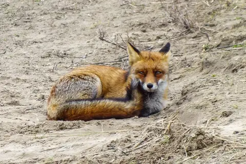
With this route you walk from the NS station into the peace of nature. Spot seals at the Noordvoort nature reserve from the sea strip and come face to face with foxes and deer in the Amsterdam Waterleidingduinen. A unique walk.
- Start location
- Zandvoort
- Distance
- 11.2 km
-
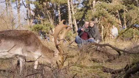
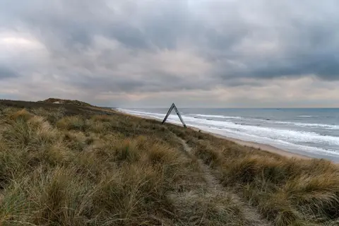
Herten Route
The Waterleidingduinen is home to the largest population of fallow deer in the Netherlands. With this route you walk off the paths through the forests in search of these beautiful animals. Not that you have to look far: in the area you are guaranteed deer. So enjoy the deer and the surroundings during the walk.
- Start location
- Zandvoort
- Distance
- 6.4 km
-
Rondje om de Zuidduinen
The Zuiderduin loop takes you through the southern dunes of Zandvoort and a part through the Amsterdam Waterleidingduinen. Enjoy the fresh sea air, the animals in the AWD and the beautiful views.
- Start location
- Zandvoort
- Distance
- 9.5 km
-
De Vier Kernen van Zandvoort
This route takes you along the four cores of Zandvoort; beach, circuit, nature and the village. Along the beach you drive to Bloemendaal, here you drive into the dunes towards Parnassia. Drink a nice cup of coffee here and then continue your route back to Zandvoort along the circuit.
- Start location
- Zandvoort
- Distance
- 13.3 km
-
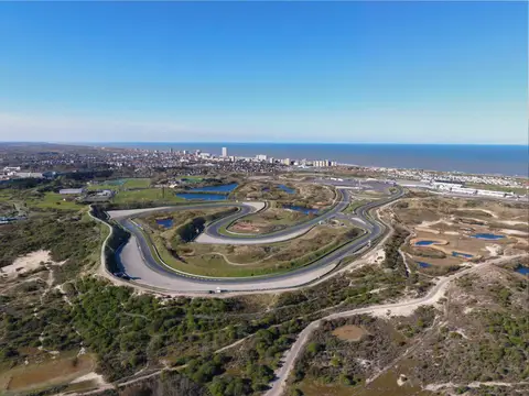
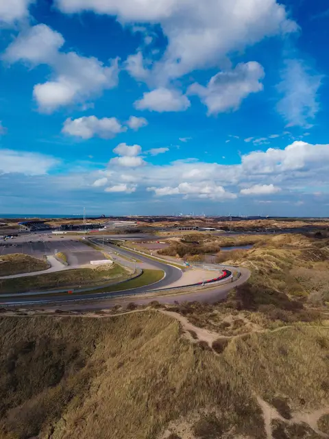
Rondje Circuit Zandvoort
Circuit Zandvoort has an almost magical attraction. The walking route along all the bends of the circuit tells the history of the track and the heroic races that have been held here.
- Start location
- Zandvoort
- Distance
- 6.6 km
-
De Fijnproever Tour
This route offers you the peace of nature on the one hand and the coziness of the surrounding villages on the other. A good balance because you end the route with a nice piece through the dunes. Along the way you will come across enough nice places for a cup of coffee, a good lunch or a drink.
- Start location
- Zandvoort
- Distance
- 32.5 km
-
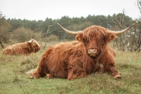
Hooglanders in Midden-Herenduin
National Park Zuid-Kennemerland is home to several large grazers, such as Scottish Highlanders, Konik horses and Shetland ponies. The animals roam freely here and are used to 'prune' the vegetation in a natural way. You can encounter the animals during the walk.
- Start location
- Bloemendaal
- Distance
- 17.0 km
-
Landgoederen NPZK Zuid
Cycling through the dunes of National Park Zuid-Kennemerland. An undulating landscape with lakes, valleys, forest and beach and sea. You will pass the estates Koningshof and Elswout. And in between you can take a refreshing dip in 't Wed or have a drink at Duincafé De Kennemerduinen.
- Start location
- Zandvoort
- Distance
- 25.2 km
-
Sloppieswandeling
During the Sloppies walk we take you into the history of Zandvoort. The walk goes past various locations that take you back to the time when Zandvoort was still a fishing village.
- Start location
- Zandvoort
- Distance
- 1.7 km
-
Wintergasten wandeling
The winter guest walk goes along canals and ditches, with various opportunities to walk closer to a bank. With a visit to the beautiful Zwanenplas, where many winter birds come to spend the winter. So bring binoculars!
- Start location
- Zandvoort
- Distance
- 11.7 km
-
Huisje van Wester
The Wester house is a historic building. It was originally a service house for the water pump operator. When the pumps were powered electrically, an operator was no longer needed and the house became empty. It has been renovated and opened as a landscape viewing hut.
- Start location
- Zandvoort
- Distance
- 12.0 km
-
Sculpture Route
An artistic walk through the village and along the sea.
- Start location
- Zandvoort
- Distance
- 13.0 km
-
Bunkerwandeling
In the Amsterdam Water Supply Dunes there are many bunkers, about 400. This route runs along several bunkers. They were built by Germany during the Second World War and are part of the Atlantic Wall.
- Start location
- Zandvoort
- Distance
- 5.3 km
-
MTB Parcours Zandvoort
The Zandvoort mountain bike trail is located around Circuit Zandvoort. Starting at the entrance at the old Slotemakers skid area, you'll ride approximately 10 kilometers along this challenging trail. Steep descents and climbs, as well as the longest Laarwall in the Netherlands, await you. This trail is closed during events at the circuit.
- Start location
- Zandvoort
- Distance
- 9.8 km
-
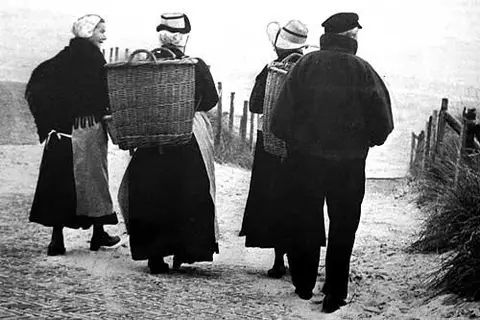
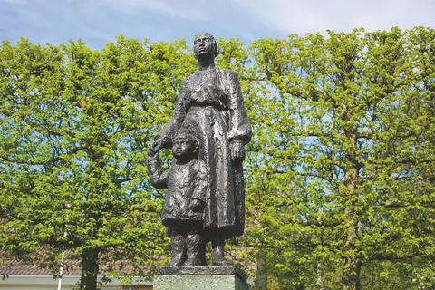
The Stinking Bucket
Zandvoort is originally a fishing village. While the men fetched the fish from the sea, the women (mostly) walked to Haarlem with a heavy basket full of fish. Here they traded them in the fish halls. With The Stinking Bucket Route, you follow in the footsteps of these fishwalkers.
- Start location
- Zandvoort
- Distance
- 12.1 km
-
De Stinkende Emmer fietsroute
Zandvoort is originally a fishing village. Where the men got the fish from the sea, the women (mostly) walked to Haarlem with a heavy basket full of fish. Here they traded them in the fish halls. With the Stinkende Emmer route you follow in the footsteps of these fishmongers.
- Start location
- Zandvoort
- Distance
- 23.3 km
-
Testroute voor Wiegert
Short description Short description Short description Short description Short description Short description Short description Short description Short description Short description Short description Short description Short description Short description Short description Short description Short description - 300 characters
- Start location
- Opmeer
- Distance
- 153,050.2 km
-
Rondje om de Zuidduinen
The Zuiderduin loop takes you through the southern dunes of Zandvoort and a part through the Amsterdam Waterleidingduinen. Enjoy the fresh sea air, the animals in the AWD and the beautiful views.
- Start location
- Zandvoort
- Distance
- 9.5 km
-
Herten Route
The Waterleidingduinen is home to the largest population of fallow deer in the Netherlands. With this route you walk off the paths through the forests in search of these beautiful animals. Not that you have to look far: in the area you are guaranteed deer. So enjoy the deer and the surroundings during the walk.
- Start location
- Zandvoort
- Distance
- 6.4 km
-
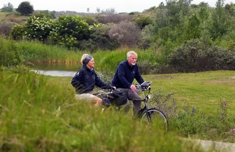
Natuurlijk Zandvoort
With this route you cycle along the many faces that the area around Zandvoort has to offer. From Zandvoort you cycle along the Amsterdam Waterleidingduinen through Bentveld and Heemstede to Haarlem. For the return journey you cycle over the Visserspad and Duinpieperpad.
- Start location
- Zandvoort
- Distance
- 26.9 km
-
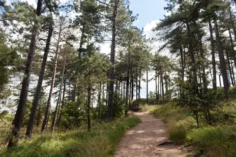
Rondom het Kraansvlak
This route takes you through the beautiful nature around Zandvoort. In Zandvoort you drive via Bentveld into the dunes towards the forests of Koningshof and Elswout. Along the Zeeweg you drive towards Bloemendaal aan Zee. Via the Duinpieperpad you drive through the dunes back to Zandvoort.
- Start location
- Zandvoort
- Distance
- 20.8 km
-
Huisje van Wester
The Wester house is a historic building. It was originally a service house for the water pump operator. When the pumps were powered electrically, an operator was no longer needed and the house became empty. It has been renovated and opened as a landscape viewing hut.
- Start location
- Zandvoort
- Distance
- 12.0 km
-
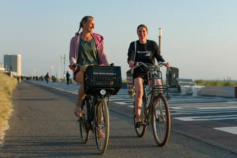
Ronde van Zandvoort
Cycling along the coast, through varied dune landscapes and past impressive villas. Look around you during your trip through the NPZK. This area is home to many Konik horses, Scottish Highlanders, foxes and deer. A small moment of happiness during the trip.
- Start location
- Zandvoort
- Distance
- 25.3 km
-
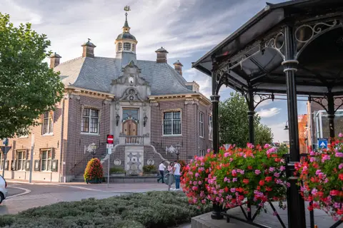
Naar Amsterdam en terug
This route takes you through a wide variety of villages and towns, all located between Zandvoort and Amsterdam. From the countryside to the city, and from the city via the Amsterdam Forest back to the polder. A diverse route that showcases a beautiful part of the Netherlands.
- Start location
- Zandvoort
- Distance
- 106.2 km
-
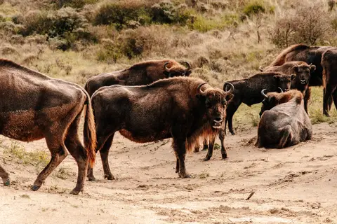
Wisentenroute
The Kraansvlak is one of the few areas in the Netherlands where the Wisent lives. These European Bisons can have a back height of up to 2 meters high and are therefore incredibly impressive to see. They are wild animals so keep your distance.
- Start location
- Zandvoort
- Distance
- 9.4 km
-
Route naar Noordvoort
With this route you walk from the NS station into the peace of nature. Spot seals at the Noordvoort nature reserve from the sea strip and come face to face with foxes and deer in the Amsterdam Waterleidingduinen. A unique walk.
- Start location
- Zandvoort
- Distance
- 11.2 km
-
De Fijnproever Tour
This route offers you the peace of nature on the one hand and the coziness of the surrounding villages on the other. A good balance because you end the route with a nice piece through the dunes. Along the way you will come across enough nice places for a cup of coffee, a good lunch or a drink.
- Start location
- Zandvoort
- Distance
- 32.5 km
-
Landgoederen NPZK Zuid
Cycling through the dunes of National Park Zuid-Kennemerland. An undulating landscape with lakes, valleys, forest and beach and sea. You will pass the estates Koningshof and Elswout. And in between you can take a refreshing dip in 't Wed or have a drink at Duincafé De Kennemerduinen.
- Start location
- Zandvoort
- Distance
- 25.2 km
-
Rondje Vogelenmeer en Kraansvlak
This walk has almost everything you can find in National Park Zuid-Kennemerland: beach, dunes, diversity and with a bit of luck also Wisents. A beautiful walk from Zandvoort along the unique Vogelenmeer and the Wisent lookout point.
- Start location
- Zandvoort
- Distance
- 18.9 km
-
De Vier Kernen van Zandvoort
This route takes you along the four cores of Zandvoort; beach, circuit, nature and the village. Along the beach you drive to Bloemendaal, here you drive into the dunes towards Parnassia. Drink a nice cup of coffee here and then continue your route back to Zandvoort along the circuit.
- Start location
- Zandvoort
- Distance
- 13.3 km
-
Rondje Circuit Zandvoort
Circuit Zandvoort has an almost magical attraction. The walking route along all the bends of the circuit tells the history of the track and the heroic races that have been held here.
- Start location
- Zandvoort
- Distance
- 6.6 km
-
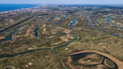
Bunkerwandeling
In the Amsterdam Water Supply Dunes there are many bunkers, about 400. This route runs along several bunkers. They were built by Germany during the Second World War and are part of the Atlantic Wall.
- Start location
- Zandvoort
- Distance
- 5.3 km
-
De Duinronde
This route takes you through the various dune areas around Zandvoort. From IJmuiden to Noordwijk. Every spot is different and has its own beauty. Along the route you can spot different types of animals so pay close attention. Maybe you will see a deer or a Scottish Highlander!
- Start location
- Zandvoort
- Distance
- 59.2 km
-
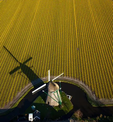
De Bloembollenroute
The flower bulb route is a versatile route where you see many different landscapes. Along the Amsterdam Waterleidingduinen you cycle along the coast towards Noordwijk. Once you arrive in Noordwijk you can enjoy the beautifully colored bulb fields.
- Start location
- Zandvoort
- Distance
- 36.4 km
-
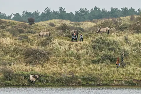
Wandelen naar de pier van IJmuiden
From Zandvoort to IJmuiden is a beautiful route between the two seaside resorts. You walk over the Zandvoort beach via Bloemendaal aan zee to the pier of IJmuiden and back through the Zuid-Kennemerland National Park.
- Start location
- Zandvoort
- Distance
- 29.3 km
-
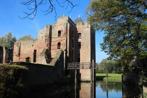
De Jagersroute
This route takes you through a large piece of nature with a small excursion to the big city of Haarlem. Here you have the opportunity to catch your breath during a cup of coffee or lunch and then end your route through another piece of dunes.
- Start location
- Zandvoort
- Distance
- 43.4 km
-
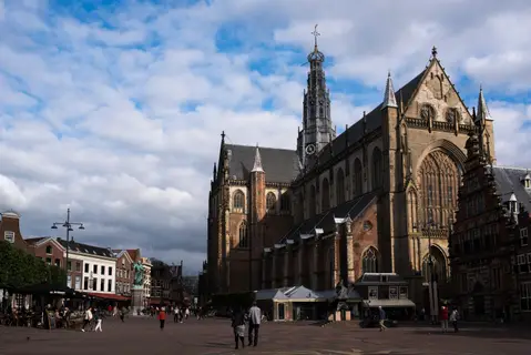
Rondje Haarlem
During this route you will cycle a nice round around Haarlem and ride through the various smaller villages that embrace Haarlem. They all have their own charm but let Haarlem shine in their midst. Cycle through the polder and cross the water on the most beautiful bridges.
- Start location
- Zandvoort
- Distance
- 59.0 km
-
MTB Parcours Zandvoort
Around Circuit Zandvoort lies the mountain bike course of Zandvoort. from the entrance at the old slip terrain of Slotemakers you ride about 10 kilometers over the challenging course. Steep descents and climbs and the longest Laarwall in the Netherlands.
- Start location
- Zandvoort
- Distance
- 9.8 km
-
Sloppieswandeling
During the Sloppies walk we take you into the history of Zandvoort. The walk goes past various locations that take you back to the time when Zandvoort was still a fishing village.
- Start location
- Zandvoort
- Distance
- 1.7 km
-
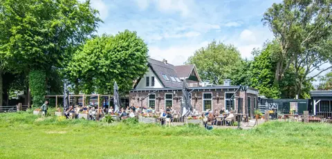
De Stinkende Emmer
Zandvoort is originally a fishing village. Where the men got the fish from the sea, the women (mostly) walked to Haarlem with a heavy basket full of fish. Here they traded them in the fish halls. With the Stinkende Emmer route you follow in the footsteps of these fishmongers.
- Start location
- Zandvoort
- Distance
- 12.1 km
-
Hooglanders in Midden-Herenduin
National Park Zuid-Kennemerland is home to several large grazers, such as Scottish Highlanders, Konik horses and Shetland ponies. The animals roam freely here and are used to 'prune' the vegetation in a natural way. You can encounter the animals during the walk.
- Start location
- Bloemendaal
- Distance
- 17.0 km
-
Sculpture Route
An artistic walk through the village and along the sea.
- Start location
- Zandvoort
- Distance
- 13.0 km
-
Ronde Zandvoort - Haarlem
With this route you make a small excursion outside Zandvoort. Through the dunes you cycle to Haarlem where you can enjoy the city life. There are enough places here to recharge or explore the city in between. Via the other side you cycle back to Zandvoort.
- Start location
- Zandvoort
- Distance
- 27.0 km
-
Wintergasten wandeling
The winter guest walk goes along canals and ditches, with various opportunities to walk closer to a bank. With a visit to the beautiful Zwanenplas, where many winter birds come to spend the winter. So bring binoculars!
- Start location
- Zandvoort
- Distance
- 11.7 km
-
De Stinkende Emmer fietsroute
Zandvoort is originally a fishing village. Where the men got the fish from the sea, the women (mostly) walked to Haarlem with a heavy basket full of fish. Here they traded them in the fish halls. With the Stinkende Emmer route you follow in the footsteps of these fishmongers.
- Start location
- Zandvoort
- Distance
- 23.3 km